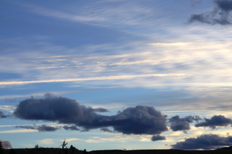
The lower clouds, including the predominant dark cloud, are Cumulus humilis. In the middle are weak Altocumulus undulatus with a lingering contrail and the upper most clouds are Cirrostratus fibratus. January 24 around 5 p.m, near the intersection of CO Hiwys 93 and 128.By James Shefchik for Spring 2013 Clouds 1.
Read the Report
Three Levels of Clouds, January 24, 2013
![](https://www.flowvis.org/wp-content/uploads/2016/07/2013SpringCloudsFirstJames_Shefchik.jpg)
Three Levels of Clouds, January 24, 2013
Categories
Search for content or authors
Flow Vis Guidebook
- Particles in Flow
- Introduction to the Guidebook
- Overview 1: Phenomena. Why Does It Look Like That?
- Overview 2: Visualization Techniques
- Overview 3: Lighting
- Overview 4 - Photography A: Composition and Studio Workflow
- Overview 4 - Photography B: Cameras
- Overview 4 - Photography C: Lenses - Focal Length
- Overview 4 - Photography C: Lenses - Aperture and DOF
- Overview 4: Photography D: Exposure
- Overview 4 - Photography E - Resolution
- Overview 5 - Post-Processing
- Clouds 1: Names
- Clouds 2: Why Are There Clouds? Lift Mechanism 1: Instability
- Clouds 3: Skew - T and Instability
- Clouds 4: Clouds in Unstable Atmosphere
- Clouds 5: Lift Mechanism 2 - Orographics
- Clouds 6: Lift Mechanism 3 - Weather Systems
- Boundary Techniques - Introduction
- Dye Techniques 1 - Do Not Disturb
- Dye Techniques 2 - High Visibility
- Dye Techniques 3 - Light Emitting Fluids
- Refractive Index Techniques 1: Liquid Surfaces
- Refractive Index Techniques 2: Shadowgraphy and Schlieren
- Art and Science
- TOC and Zotpress test
- Photons, Wavelength and Color