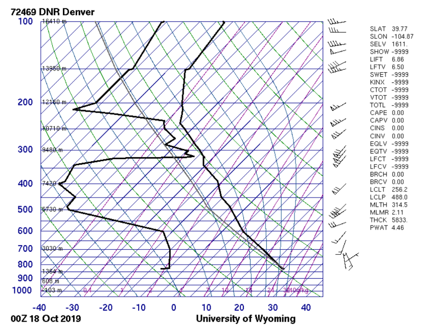
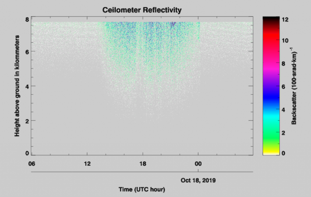
The CAPE from Skew-T was measured to be 0 meaning a stable atmosphere. This oddly shaped skew-T seems to determine that clouds most dense between 9500 and 10800 meter ( 312000 to 354000) which is typical for cirrus clouds but looking at the celiometer it can be seen that their were clouds present lower in the atmosphere at levels more likely for lenticular altostratus clouds.
7 Comments. Leave new
I liked that the previous 3 photos and yours share the same cloud but different perspectives
I like the colors in this image. Great timing for taking pictures!
It looks like an imminent sand storm
I like how orange the cloud is
These are definitely the most vibrant colors captured of this cloud. I’m glad the flow looks so crisp in your picture.
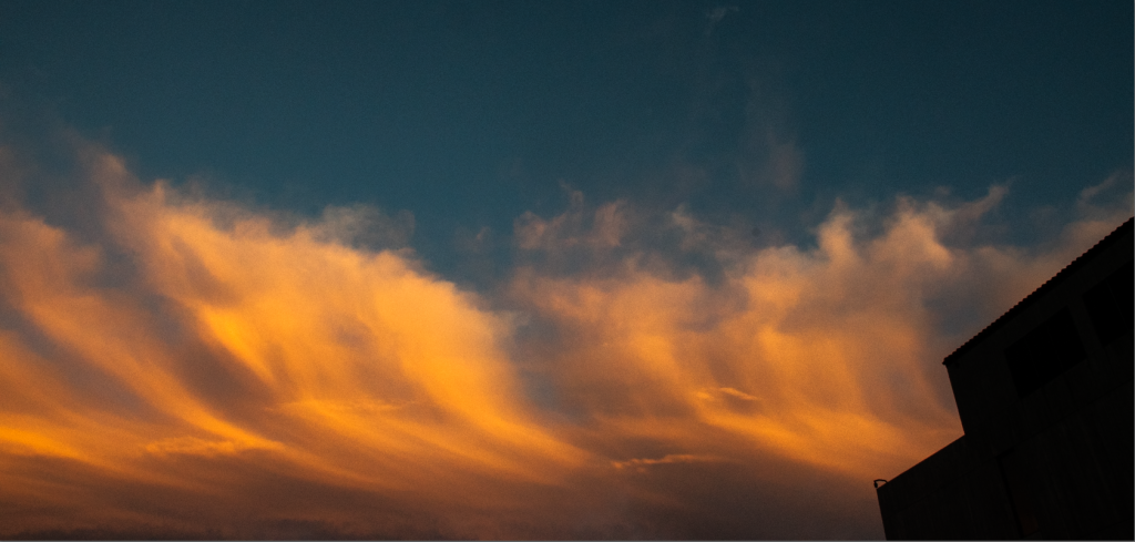
I think that having the building silhouetted is helpful, because it gives some scale to what we are seeing
I love how black the building is it gives great contrast.