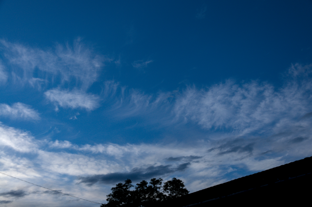
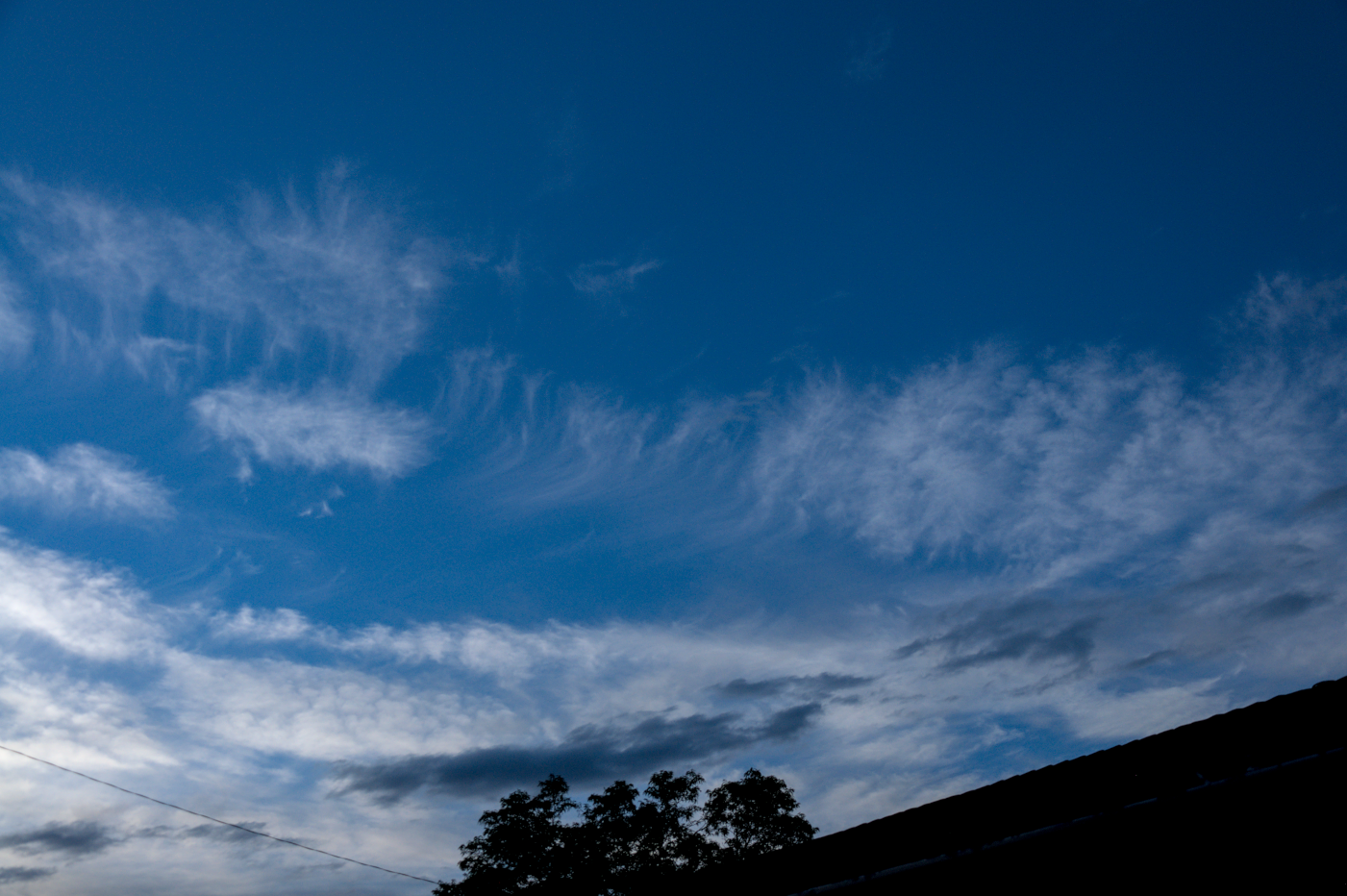
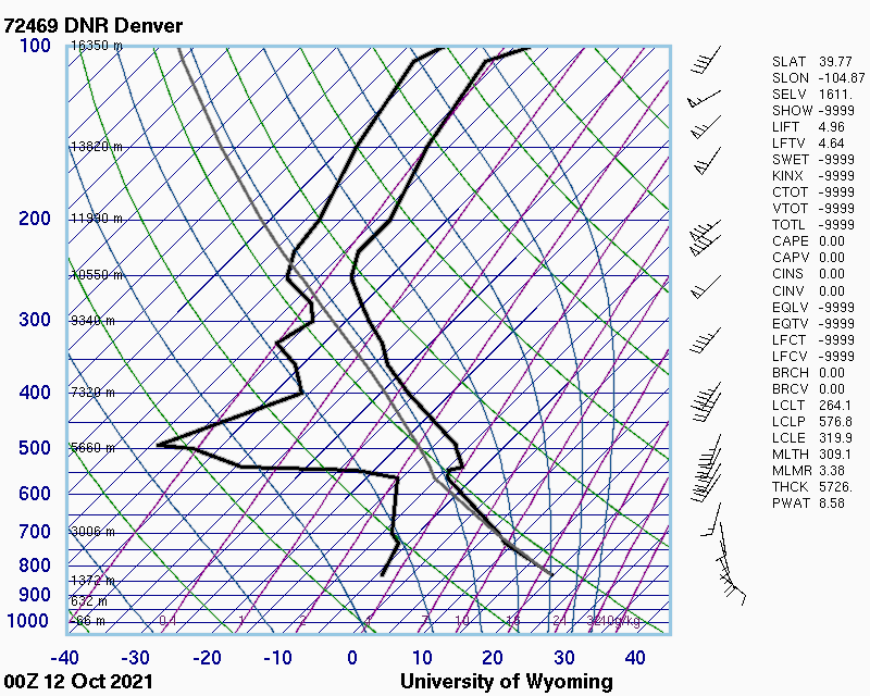
This picture shows two distinct layers of clouds. The lower group, both in altitude and in the frame, appears to be occurring around 4 km above the ground, based on the skew-T diagram. Because these clouds are not particularly puffy, my guess is that they are stratus clouds. Above them, we see the second grouping, which is occurring around 10 km, based on the skew-T diagram. These clouds also don’t appear to be fluffy, so I think that they are altostratus clouds. Take note of the high wind speeds in this region, which is marked by the flags on the right of the skew-T plot. These winds are most likely causing shearing in this cloud layer, which we see near the center of the frame.
Taken near 28th and College in Boulder, Colorado, at approximately 6:00pm (MST) on October 11, 2021.
1 Comment. Leave new
The skew-T is really interesting that it shows the shear generating the top of the clouds. Good choice to take it at 6pm!