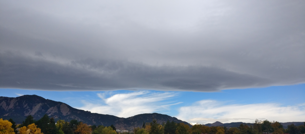
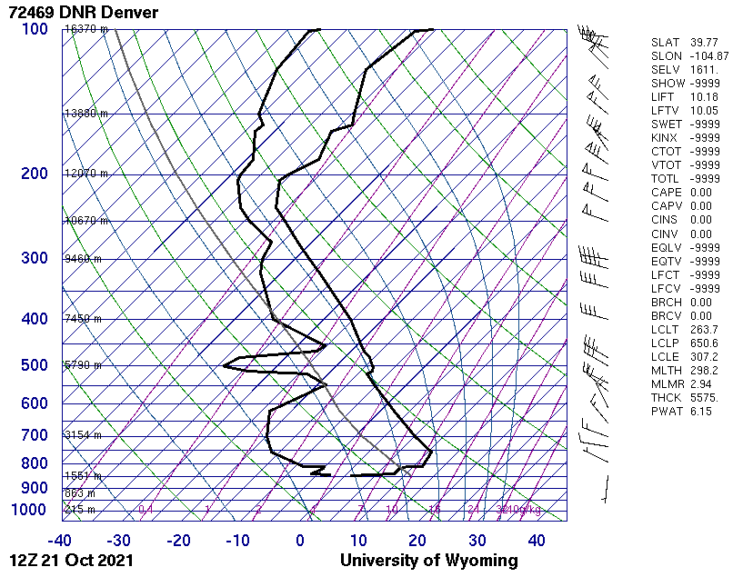
Wall of cumulus clouds facing east over Boulder, taken Oct. 21st, 2021 at 11:14am MST Corresponding Skew-T diagram at nearest time of capture. As far as I know, all the sounding parameters don’t seem to indicate any sort of instability, although I still don’t know what it means when half of them are -9999. I wasn’t able to find out what the THCK value represents, and I think it might be a typo because the Wyoming parameter definitions define MLMR and PWAT, but have THTK rather than THCK (http://weather.uwyo.edu/upperair/indices.html).