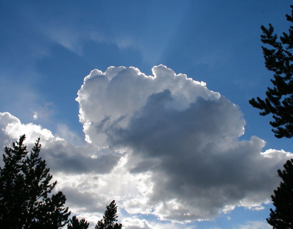
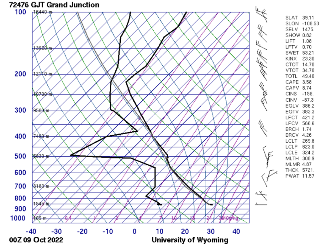
Cumulus congestus and stratocumulus clouds above Gilpin County, Colorado, spotted 10/8/2022. The Skew-T diagram below from Grand Junction suggests that the clouds likely occurred around 4000m or between about 7500m to 12000m, and it also reports a CAPE value of only 3.58, which suggests a conditionally stable troposphere, which likely differs from what I observed, as a towering cumulus such as this one is more likely to occur in a less stable atmosphere.
5 Comments. Leave new
I like the shadow on the top left, is it a shadow or cirrus?
Really great shot of this cloud, you did a good job dialing in the exposure to capture various layers of light present in the cloud. I also think the ring of light in the upper left is really cool!
I really enjoy the light coming through the clouds and how you captured the full form of the clouds.
I like how the sun rays are visible, and also the shadow that the clouds cast on them.
I really like how central and focused the cloud is as the subject and how the sunlight peeking from behind the cloud causes the edges to glow very brightly.