The third common lift mechanism is synoptic scale lift, another obscure term that means air is lifted over a very large area (several states wide), driven by weather systems. Weather is a delightfully complex topic, involving the movement of high and low pressure areas, and of relatively warm and cold air masses all over the planet. The National Weather Service has a clear, concise overview of the physics of weather systems . I don’t want to reinvent the wheel, so I’ll just send you there for a detailed understanding and steal a few images for illustration here.
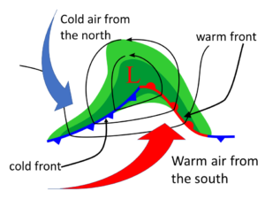
What we think of as a weather system is usually a region of low pressure. Not very low, mind you, typically 2% lower than average. The low pressure area draws in air at the surface, and the Coriolis effect makes that incoming air rotate counterclockwise (in the northern hemisphere) around the low pressure zone, as shown in Figure 1. The whole system usually moves from west to east, driven by the jet stream. Warm air rotates up ahead of the low from the south, and cold air rotates down behind the low from the north. Warm fronts are where the incoming warm air meets retreating cold air at the surface. But the front on the surface is not where the action is. Instead, the warm air, being less dense, slides up over the cooler air ahead of the system, as shown in Figure 2. The warm front is actually at the back end of this process. Maybe it should be called the warm tail?
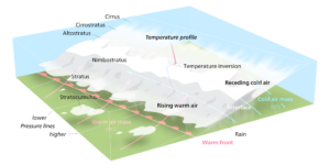
If you stand on the ground as a weather system approaches you from the west, you’ll first see cirrus clouds a day or two before the rest of the system arrives. Next, you may see cirrostratus, a thin veil covering much of the sky. Over time, this can acquire visible darker areas, signaling that the cirrostratus has become altostratus as the interface between air masses lowers. These clouds occur in stable air, as the relatively warm air is above cooler air. The uplift that maintains these clouds comes from the warmer air riding up over the cooler air, creating large, flat cloud layers. As the warm front nears you, you may see the cloud base drop down, and it may rain or drizzle, indicating the layer is now a nimbostratus. After the warm front sweeps past you, the temperature may rise, and the skies clear except for some stratocumulus. You might have a day of sunny, nice weather before the cold front arrives.
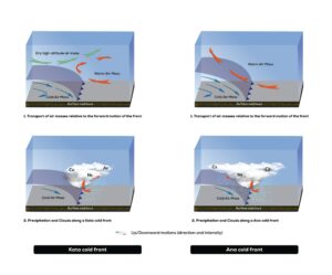
Cold fronts can be much more complex, depending on the exact shape of the front, the upper air winds, and the relative humidity of the various air masses . Figure 3 shows two types of cold front, the Ana front, and the Kata front. Here in Boulder, Colorado, we often get Ana fronts in winter, where we have upslope winds (from east to west) that bring us the distinctive odor of the stockyards in Greeley. In this case, precipitation develops during or after passage of the cold front and its accompanying low pressure region.
Almost any type of cloud can accompany a cold front. Localized instability can lead to cumulus through cumulonimbus clouds, resulting in ‘thundersnow’ in winter. All types of stratus clouds can appear, in reverse order to those seen in a warm front, ending with cirrus a day or two after the storm. Figure 4 is a time lapse of a stratus cloud giving way to cumulus and stratocumulus after an Ana front.
Figure 4: Time lapse of clearing stratus at the end of an upslope event, Boulder, CO, Nov. 5, 2015 from 10:25 AM to 12:17 PM. By Joanna Bugajska for Clouds Second Fall 2015.
This whole sequence of events is a simplified, idealized version, known as the Norwegian cyclone model . What you actually see can vary dramatically, depending on the age of the system, and whether it passes north or south of you, but this model should give you enough information to diagnose your clouds from fall to spring, and give you an idea of what to look for.
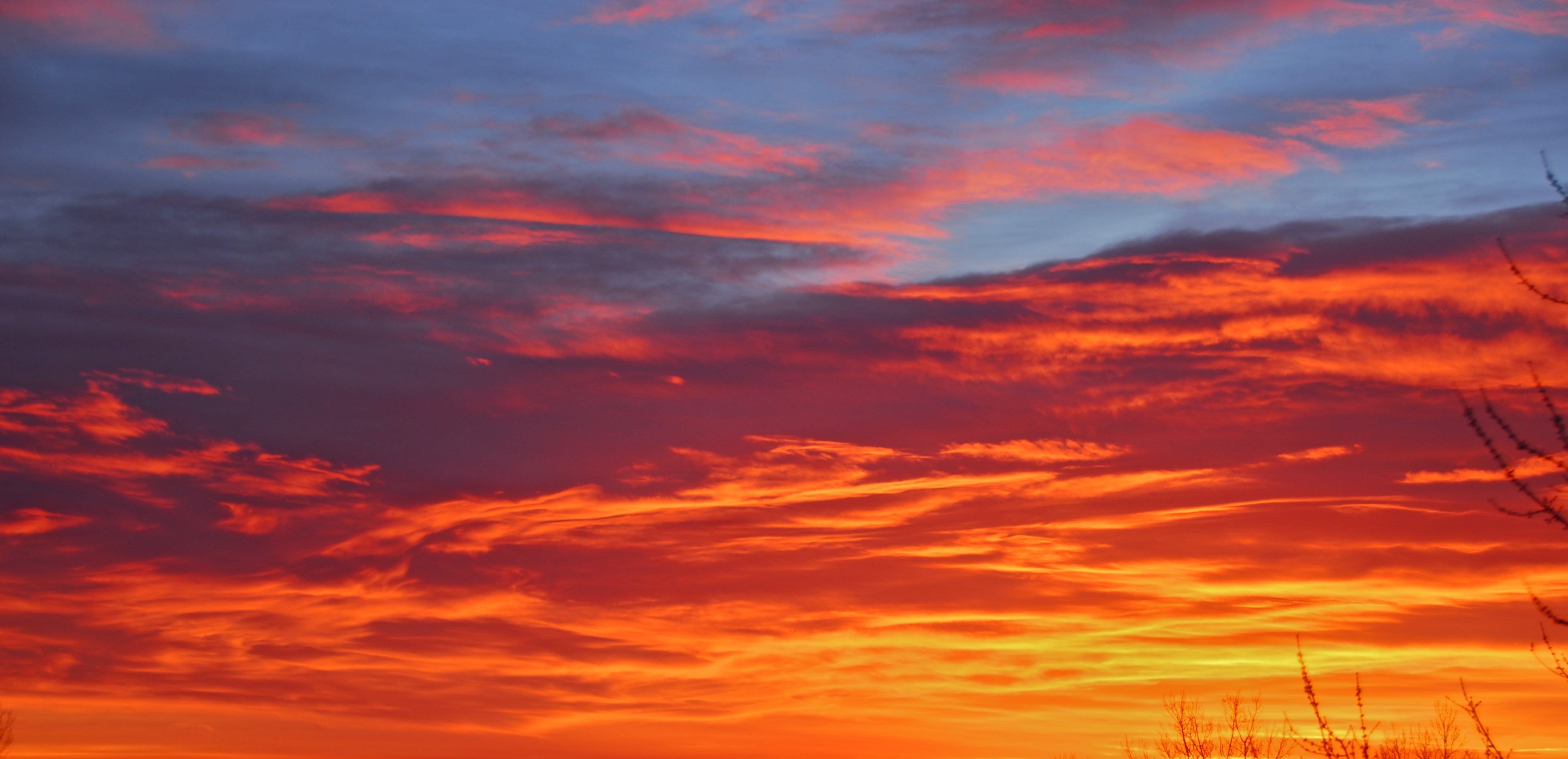
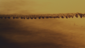
Photographing stratus type clouds is challenging, as they sometimes appear to be devoid of features, and who wants a plain gray image? There are several approaches that can work spectacularly. Figure 5 illustrates how the sun angles at dawn and sunset can highlight subtle height variations on the underside of a stratus layer. Figure 6 shows how stratus clouds can lend interest as a gradient background.
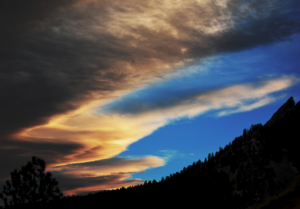
Altostratus clouds can have definite boundaries, as shown in Figure 7. This formation is not unusual here in Boulder, with the leading edge of an altostratus shield forming just downwind (east) of the mountains.
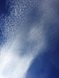
Figure 8 shows a complex phenomenon as altostratus breaks up into altocumulus stratiformis. The top of the cloud reflects sunlight and cools, while the bottom of the cloud absorbs infrared radiation from the earth’s surface . This results in a slight, local instability, causing Rayleigh-Benard convection cells to form. Relatively warmer air rises in the middle of the cloudlets, while cooler air descends around the outside, evaporating the cloud as it goes, and allowing the blue sky to show through.

